-40%
PENNSYLVANIA / DELAWARE / Franklin's Map of Main Line Eastern Delaware 1933
$ 124.08
- Description
- Size Guide
Description
Franklin's Map of Main Line, Eastern Delaware County and Portions of Chester County. Map title: Map of the Main Line and Eastern Delaware County, Including Portion of Chester County in PennsylvaniaAuthor:
PENNSYLVANIA / DELAWARE)
Title:
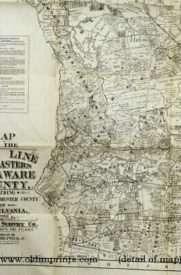
Franklin's Map of Main Line, Eastern Delaware County and Portions of Chester County. Map title: Map of the Main Line and Eastern Delaware County, Including Portion of Chester County in Pennsylvania
Publication:
Philadelphia. Franklin Survey Co., 1933
Description:
Philadelphia. Franklin Survey Co., 1933.
Black and white road / street map, 39 x 31 1/2 on sheet size 41 1/2 x 33 1/2 folding into 9 1/2 x 6 inch stiff card wrappers. Light soiling and edge wear to covers, one inch tear to lower right edge (outside map area) with discoloration from old tape repair, several 1/2 inch separations at fold intersections, a few soft creases, very clean map. Unusually detailed map with landowners' names marked, a great historical reference for the area. Map extends from Schuylkill River at upper right (with an inset of Phoenixville at upper right), Valley Forge Park in the centre upper right; to Malvern and Willistown, Edgmont, Newtown, Upper Providence; Nether Providence, Springfield, Ridley at lower left; outskirts of City of Chester at lower left; outskirts of city of Philadelphia at lower right. Legend includes Golf Courses, Improved Roads, Railroads, Trolley Lines, Parks & Parkways, Proposed Streets, etc. Scale of approximately 3,000 feet to 1 inch. Printed at lower left corner: Edition #229-1029 Revised 11-6-33. Item #40775
Seller ID:
40775
Subject:
Ephemera, Maps, United States
OldImprints
Here on our eBay store we sell genuine antique and vintage maps, prints, books, magazines and ephemera
- these are NOT reproductions or copies. Our stock ranges in date from the 1600s to the 1950s - great design is not limited by date! We have been in business since 1981, and have thrived on (or survived!) the many changes in the book and antique world. Our business is web based in Portland, Oregon, USA; we also exhibit at several shows a year. Owner Elisabeth Burdon is a member of the Antiquarian Booksellers Association of America, an affiliate of the International League of Antiquarian Booksellers and a member of the Ephemera Society of America and the American Historical Print Collectors Society.
Terms
PayPal is preferred. All orders ship within one business day. Standard mail is USPS First Class or Media Mail depending on item and weight. Expedited and international shipping are also available. We offer combined shipping on multiple orders. Ask us before placing an order if you wish to upgrade shipping or need us to ship overseas. Please note that the buyer is responsible for all customs and import charges for items shipped overseas. For sales within the U.S. Ebay now collects sales tax on items sent to many states: "
eBay
will calculate and add the applicable
sales tax
at checkout. The buyer will pay both the cost of the item along with the
sales tax
."
All items are guaranteed to be as described or they may be returned within 30 days of receipt for a full refund including return shipping. Please contact us if you have any concerns about your order so that we can address them - our aim is to provide an all-round positive experience for all involved.
This listing was created by Bibliopolis.


